
J.F. Mitchell Airport
Across the channel
Bequia is reached from Argyle on the mainland by the short-haul aircraft that work the island chain.
From Argyle
22 km 12 nm
Runways across the network
St. Vincent SVD
2,743m 9,000 ft
Canouan CIW
1,791m 5,880 ft
Bequia BQU
1,100m 3,610 ft
Union Island UNI
752m 2,470 ft
An island of sailors that reclaimed the ground for its runway
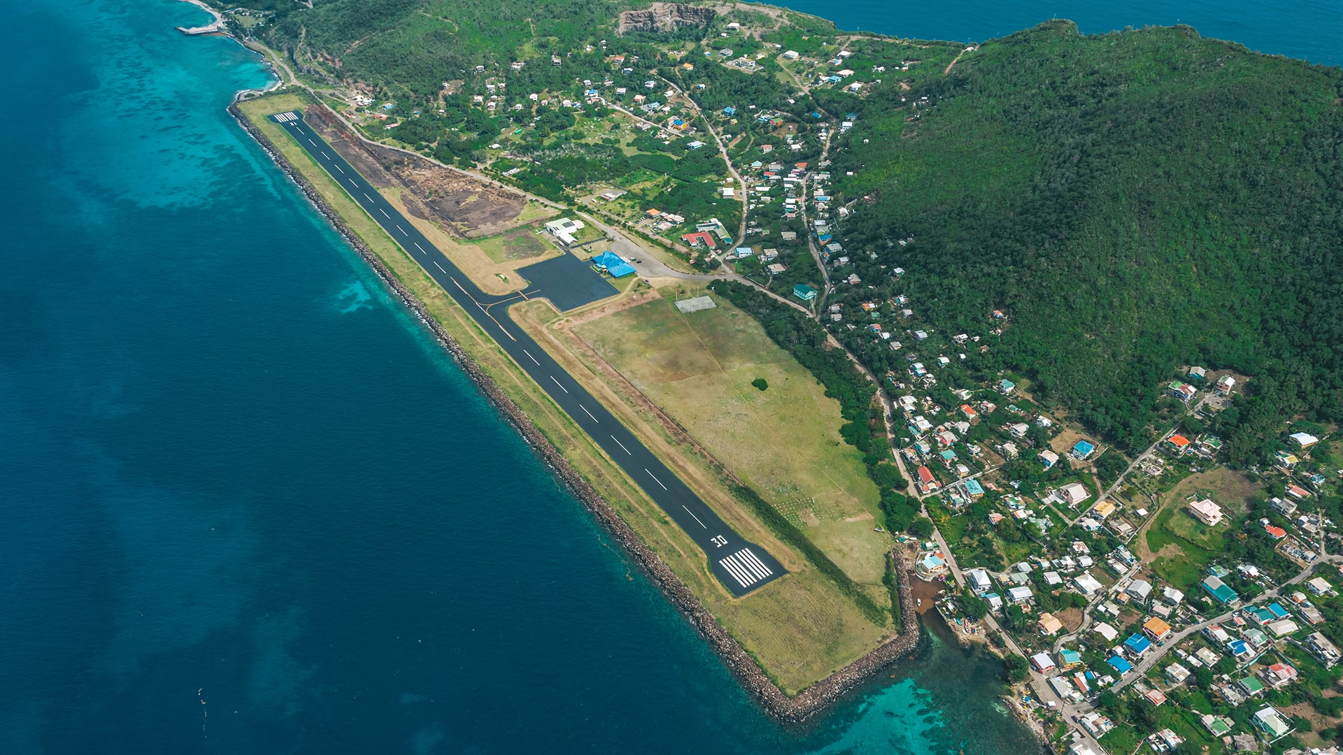
Until the 1990s, reaching Bequia meant the ferry across the channel from Kingstown. In 1990 a land-reclamation project began at Paget Farm on the island’s southwestern tip, winning enough flat ground from the shoreline to lay a runway on an island that had almost none.
J.F. Mitchell Airport opened on 15 May 1992, named for Sir James Fitz-Allen Mitchell — Bequian by birth, Premier and later Prime Minister of St. Vincent and the Grenadines, and the driving force behind the island’s link to the air.
It remains a small field by design: a 1,100-metre strip taking turboprops and light aircraft, with an apron that holds two ATR-sized aircraft or five smaller ones at a time.
Bequia in figures
- Island area
- 7 sq mi
- Resident population
- 5,500
- Admiralty Bay anchorage
- 100 yachts
- Airport opened
- 1992
One of the finest anchorages in the Caribbean
Most visitors arriving at Paget Farm are heading for the water. Admiralty Bay is a broad, sheltered harbour on the island’s northwest coast with room for around a hundred yachts, and it has been a fixture of Eastern Caribbean cruising for decades.
Ashore, Port Elizabeth’s waterfront runs to chandlers, market stalls, and the long-standing bars and kitchens along Front Street. The Princess Margaret Trail follows the coast from Fort Hamilton around to Lower Bay.
Aerodrome data
| Item | Value |
|---|---|
| IATA / ICAO | BQU / TVSB |
| Runway | 12 / 30 · asphalt |
| Runway length | 1,100 m — 3,609 ft |
| Elevation | 4.6 m — 15 ft |
| Coordinates | 12°59′18″N 61°15′43″W |
| Opened | 15 May 1992 |
| Apron | Two ATR-sized or five light aircraft |
| Named for | Sir James Fitz-Allen Mitchell |